
Galveston Neighbors: Block Sources
Public sources around a Galveston address describe land and record relationships. County and City GIS layers show adjacent parcel shapes and fields such as situs, legal description, ZIP, land use, and neighborhood. GCAD adds appraisal and owner context. County Clerk records can connect a parcel to a deed or plat. Those sources are useful for understanding a block, but none proves who is physically present in every structure. Begin with the record that fits the question, and retain the source label with each result.
| Source | What It Shows About a Block | Access |
|---|---|---|
| County or City GIS parcels | Adjacent geometry, situs, legal, ZIP, land-use, and public attributes | Viewer or service; boundaries are approximate |
| GCAD eSearch | Owner, mailing destination, appraisal, and parcel context | Public eSearch by parcel |
| County Clerk deeds and plats | Lot, block, subdivision, and transfer relationships | Fidlar, AVA, or copy request |
| City permit layer | Public site activity, record status, and named parties | Accela and ArcGIS routes |
| GTHC neighborhood files | Association boundaries, surveys, maps, and block history | Finding aids and reading room |
| Texas HOA certificate search | Association name, city, county, ZIP, and certificate data | Public certificate route, not a member list |
The useful distinction is simple. A parcel result may identify an owner or mailing recipient. A legal description identifies land. A deed identifies parties to a transfer. None automatically identifies every neighbor living around that address.
Mapping Galveston Neighbor Parcels
The verified Galveston block method moves from the target parcel outward. Search the county viewer by address or place, select the parcel, and record the GEOID or parcel identifier together with the situs and legal fields. Pan or zoom to the polygons that share a boundary or sit immediately nearby. Then open each identified parcel in GCAD and compare what the appraisal roll says with its recorded legal description. The city parcel service exposes GEOID, NAME, ADDRESS, CITY/ST/ZIP, SITUS, LEGAL, acreage, land use, neighborhood, and value fields for this comparison.
- Find the target address in the county interactive map and select its parcel.
- Capture the target’s GEOID, situs address, and legal description before comparing nearby polygons.
- Identify adjacent geometries, then record each neighboring GEOID and situs rather than guessing from a map label.
- Open the parcel records in GCAD and compare owner, mailing, legal, and deed-history context.
- Use County Clerk plats or deeds if an alley, lot line, subdivision, or block relationship needs resolution.
Start at the Galveston City parcel service when a service-level view of the parcel fields is useful.
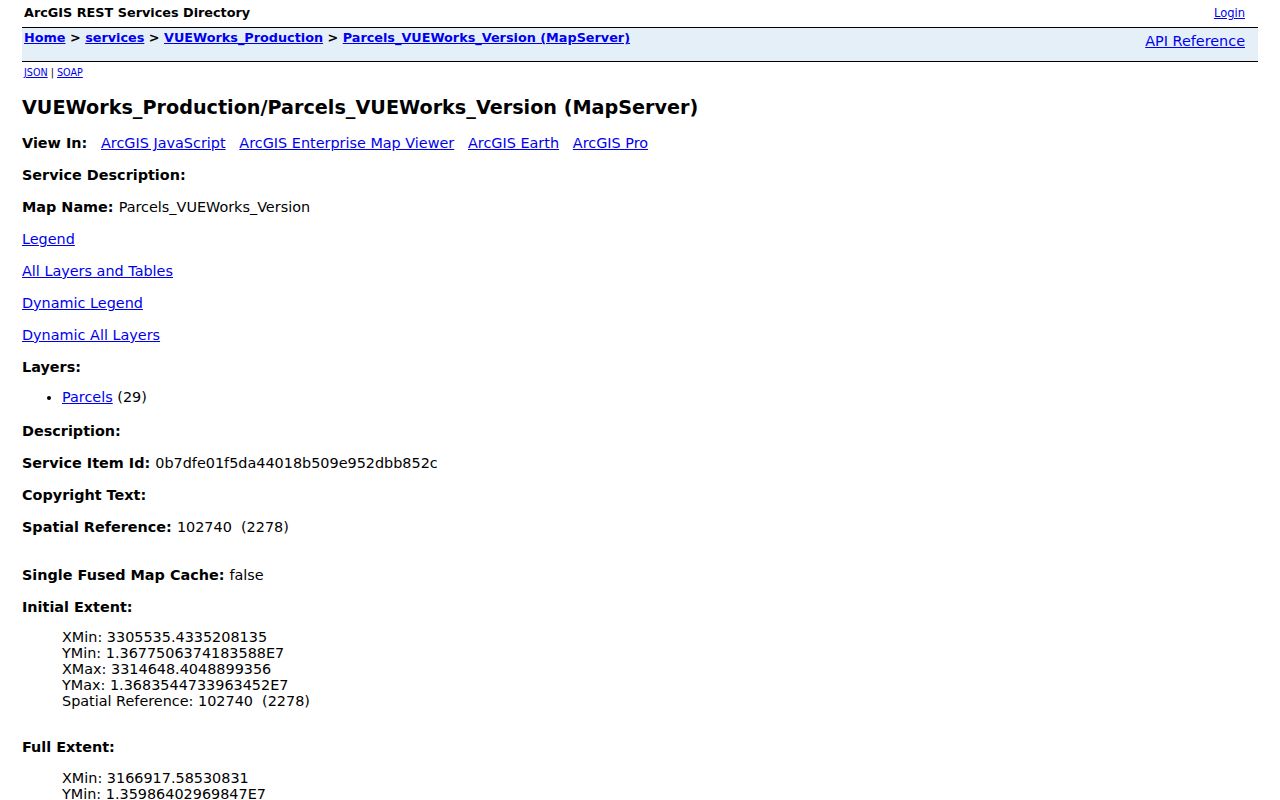
The service supports a record-based comparison of nearby parcels. Its geometry is informational and approximate, not a legal survey or proof of a shared household.
Galveston Neighbor GEOID Records
GCAD’s owner-name, street-number, street-name, property-ID, Geo ID, subdivision, neighborhood, and tax-year fields can narrow each parcel after the GIS step. Keep the physical situs and the tax mailing address in separate notes. The mailing destination can be different from the parcel location, and a homestead indicator is an appraisal-context detail rather than proof of presence on a particular day.
Use the Geo ID and legal description to make the next step less ambiguous. In the County Clerk’s Fidlar or AVA records, compare grantor, grantee, instrument date, and legal description. A plat can clarify a lot, block, subdivision, street layout, or easement. If a deed describes a different legal area than the GIS parcel, pause and resolve that conflict before treating the two as the same property. For a complete named-street record chain, use the Galveston street address directory rather than stretching a block lookup into a full-street roster.
- GEOID
- A geographic or parcel identifier used to connect a mapped parcel with appraisal and related records.
- Situs address
- The physical location assigned to a parcel, which can differ from the owner’s mailing destination.
- Plat
- A recorded map that can show subdivision lots, blocks, streets, and related land relationships.
Note: A matching legal description is stronger than a nearby map label when parcels, alleys, or historic street names create uncertainty.
Galveston Neighbor Roster Myth
Myth: An adjacent parcel automatically identifies a household neighbor. In Galveston County, GIS is a land layer and GCAD is an appraisal layer. They can show the parcel, a named owner, a mailing address, and legal context. They do not create a list of non-owner household members, utility customers, delivery recipients, or every person who may use an address. A deed party can be a trust, estate, company, or attorney-in-fact instead of an everyday occupant.
This distinction is especially important on blocks with multi-unit structures, historic buildings, seasonal use, or changing ownership. A property record is still valuable. It can guide a careful search toward the right plat, instrument, permit, or local-history file. It should be described honestly as property evidence, not transformed into an identity claim it does not support.
Parcel tip. Compare the legal description before comparing names. It is the best guard against treating an adjacent-looking polygon or an old street label as the same property.
Galveston Neighbor Voter Limits
Texas voter information has its own limits. VoteTexas status information can use the pathways allowed by the state, while broader voter-list requests use the Secretary of State and county registrar process. The public statutory list context can include name, date of birth, and VUID under Election Code section 18.005, but sensitive registration information is protected under section 13.004. How someone voted is never public. A voter registration shows election-record information, not a complete block roster or a present-occupancy guarantee.
The statewide computerized voter list is available through the statutory process subject to exclusions, fee rules, and the requester affidavit in Election Code section 18.066. Section 18.067 bars commercial advertising and promotion uses. Galveston’s Tax Assessor-Collector/Elections operation handles voter registrar functions. Protected voter addresses and Address Confidentiality Program records must not be copied or reconstructed from parcel, association, court, or historic sources.
Note: A status change such as suspense signals address uncertainty or returned mail, not a conclusion about a person or a household.
Galveston Neighbor Associations
Community groups can provide a block’s public history, boundaries, preservation concerns, and meeting context. The city design-material appendix names the East End Historic District Association, Silk Stocking Historic District Association, Lost Bayou Historic District through the San Jacinto Neighborhood Association, GAIN, and the Galveston Historical Foundation Preservation Resource Center. These organizations are not a replacement for land records, and their internal memberships should not be treated as public resident lists.
| Community resource | Useful public context |
|---|---|
| East End Historic District Association | Historic-district and neighborhood context |
| Silk Stocking Historic District Association | Historic-area context and preservation interest |
| San Jacinto Neighborhood Association | Lost Bayou Historic District community route |
| GAIN | Galveston Alliance of Island Neighborhoods context |
| Galveston Historical Foundation Preservation Resource Center | Historic-place and preservation resources |
The city’s design-standards appendix is the official source captured for these named contacts. Use a public contact route for information about the area, not to request private membership details.
Galveston Neighbor HOA Certificates
The Texas HOA and COA management-certificate search adds an association layer to a Galveston block search. It can show an association name, city, county, ZIP, and certificate data. That makes it useful for confirming whether an association has filed a certificate for a location or county. It is not a list of people in an association and should not be used to infer who occupies a parcel.
Open the Galveston County HOA and COA certificate search to filter the state registry.
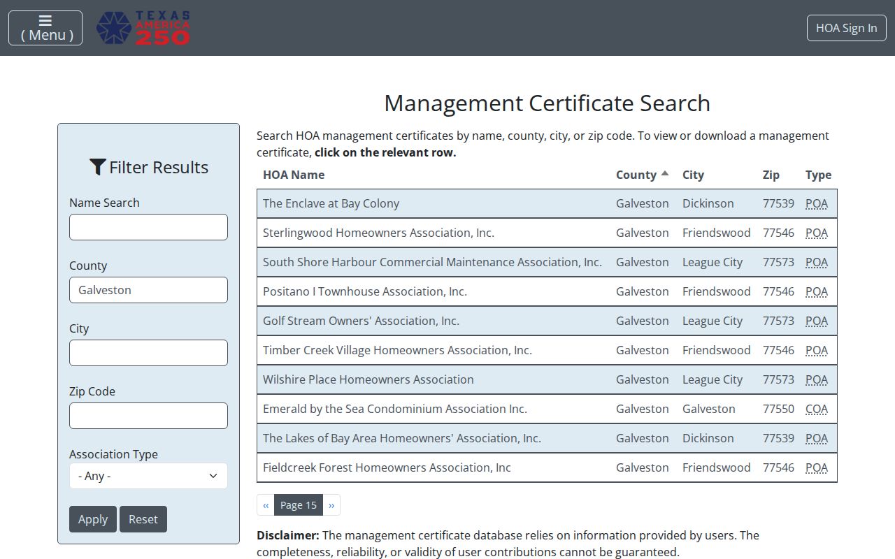
Certificate records establish the association layer. Deeds, plats, and the applicable governing documents remain the better sources for a particular parcel relationship.
Note: A filed certificate identifies an association record, not a roster of people connected to every parcel within its area.
Galveston Neighbor Historic Files
The Galveston and Texas History Center holds neighborhood and historical collections for Cedar Lawn, Oleander Park Homestead, Palm Terrace, San Jacinto, Silk Stocking, and Old Galveston Quarter. These are finding aids for association minutes, architectural surveys, maps, by-laws, and block history. They are not public member rosters. A request that gives an address, date range, and record type can help an archivist identify relevant folders or surveys.
Oleander Park offers a useful local comparison point. Its 1877 association material describes 32 and one-half acres, 182 lots, alleys, and wide streets. Compare that historical plan with current GIS geometry and recorded plats rather than relying only on a modern neighborhood label. The approach is a way to read a block’s history without making unsupported claims about its current households.
Galveston Neighbor Source Comparison
Official sources and commercial neighbor-lookup tools serve different purposes. Official rolls trace their fields to a custodian, legal record, or stated statutory process. Commercial tools may combine public filings, address histories, phone associations, marketing data, and probabilistic same-name links. Their refresh dates, costs, opt-out terms, and matching methods can change. A stale mailing address or an owner-occupant mix-up is especially risky on a block-level search.
| Source type | Best use | Main limitation |
|---|---|---|
| Official GIS, GCAD, deed, or plat record | Confirm a parcel, legal description, owner, or recorded transfer | Does not identify every household member |
| Official voter or association route | Use only under its statutory or organizational limits | Protected information and private memberships remain unavailable |
| Commercial neighbor-lookup category | Generate a lead that must be verified | Can merge names, retain old addresses, or confuse owners with occupants |
Correct a factual error first with the original custodian. The Texas Data Privacy and Security Act can give rights involving qualifying private controllers, but it does not erase a county deed, court index, or statutory voter record merely because another company copied it.
Galveston Neighbors Privacy Limits
Several boundaries protect people around a Galveston block. Non-owner household members, protected voter addresses, utility and delivery information, DMV data, and private association memberships are not open parcel-search material. Texas Address Confidentiality Program participants can use a substitute mailing address in qualifying safety circumstances. Texas Government Code sections 552.117 and 552.1175 protect qualifying contact and family details, while Tax Code sections 25.026 and 25.027 place limits on appraisal information.
Lawful use. Use Galveston neighbor records for personal, lawful block research, family history, or civic curiosity. Never use a parcel, deed, association, or voter record to watch, harass, intimidate, or harm another person.