
Map Galveston Past Residents by Era
A backward address trail uses sources with different time ranges and different meanings. Recorded instruments establish a transfer sequence. Directories and census schedules can provide household evidence for a particular date. Sanborn maps describe structures and lots, not people. Build an era map first, then use it to decide which source can answer the actual question. The County Clerk has not published a complete official online start or cutoff for its current index, so an empty online result does not prove that an older document is absent.
| Source | Years It Covers | Where Held | What It Shows |
|---|---|---|---|
| Recorded deed index | Official online cutoff not published; county created in 1838 | County Clerk Fidlar or AVA, deed books, Texas State Library and GTHC support | Grantor, grantee, instrument date, and legal description |
| GCAD deed history | Sample records show 2011–2023; sample roll history 2018–2026 | GCAD parcel card | A quick current-to-recent name and date bridge |
| Galveston city directories | 1856–2024 overall; 1859–1925 digitized routes; 1938–current bound | GTHC, Portal, HeritageQuest, and library routes | Dated address-to-occupant and household details where listed |
| Telephone directories | 1904–current | GTHC | Phone and address entries |
| Federal census | Public through 1950 | NARA and library database routes | Household composition at enumeration |
| Sanborn maps | 1885, 1889, 1899, and 1912–February 1950 volumes identified | LOC, UT Sanborn, and GTHC | Structure, lot, use, and footprint |
For a recent transfer, begin with the parcel card and recorded deed. For a household question, use a directory year near the target date and then seek a census, obituary, or other independent record. Note: A source can establish a recorded role or dated address line without proving a person occupied the property at another time.
Start Galveston Previous Residents at the Parcel
The Galveston Central Appraisal District eSearch is the practical starting point for an address history. Search by street number and street name, then copy the Property ID or Geo ID, situs address, legal description, subdivision, and every available deed-history detail. The sample parcel card documented in the research lists deed date, type, description, grantor, grantee, volume, page, and number. It also distinguishes land and value history from deed history.
GCAD is an appraisal record, not a complete title abstract. Its public page did not publish a historical online cutoff. A mailing address may be remote from the property, and a homestead exemption is not conclusive current-residency proof. Use those data as leads to the recorded instrument, then keep the legal description with the address. The legal description often survives a street-number change better than a modern mailing line.
| Parcel-card item | Why it matters in a backward trail |
|---|---|
| Property ID or Geo ID | Cross-references a parcel across appraisal and GIS records |
| Situs and legal description | Separates the physical parcel from a tax mailing address |
| Subdivision, lot, and block | Links a deed or plat to the same piece of land |
| Deed-history row | Supplies names and dates to verify in the Clerk index |
Trace Galveston Previous Residents Through Deeds
Deeds trace ownership and transfer, not everyday residency. The search begins with the current GCAD card because it supplies a likely current owner, a deed date, and the legal description needed to distinguish this parcel from another address with a similar name. In the County Clerk Fidlar index or the AVA real-property viewer, search the current owner as grantee around the GCAD deed date. Confirm that the instrument’s legal description matches before adding it to the chain.
- Capture the current owner, Property ID or Geo ID, legal description, subdivision, lot or block, deed date, and recorded deed-history names from GCAD.
- Find the current purchase instrument with the current owner as grantee. Preserve the instrument type, execution and recording dates, volume or page, number, and legal description.
- Record the seller, called the grantor, from that matching instrument. Treat that person or entity as a prior owner lead, not as proof of residence.
- Search that seller as a grantee in earlier instruments, again matching the legal description. Repeat the seller-to-prior-seller sequence while the parcel description remains consistent.
- When the online index stops, ask the Clerk about deed-book or microfilm volume access, request an official or certified copy where needed, and use GTHC or Texas State Library support for older material.
- Grantor
- The party transferring an interest in a recorded instrument.
- Grantee
- The party receiving that interest in the instrument.
- Chain of title
- The documented sequence of transfers for the same parcel or legal description.
- Legal description
- The lot, block, subdivision, or metes-and-bounds language that identifies land more reliably than an address alone.
Fidlar and AVA have public index access, but the captured official research did not verify their detailed controls or historical cutoff. The County Clerk’s records-search landing page and its copy-request route are the valid fallback when a name search is incomplete. A lien, release, foreclosure notice, probate record, trust, estate, corporation, or attorney-in-fact can interrupt the apparent sequence. Resolve the document type instead of guessing why a name changed.
Bridge Galveston Previous Residents Index Gaps
An online search boundary is not a historical boundary. Galveston County was created in 1838, but the official pages captured for Fidlar and AVA do not state when their online coverage begins or where it ends. Ask the County Clerk for the appropriate deed book or microfilm volume. The Clerk maintains Real Property and Official Records and can provide certified copies through its documented channels. GTHC and the Texas State Library offer additional microfilm and archive support when a local portal cannot reach the needed era.
Keep three dates separate: the date a deed was signed, the date it was recorded, and the date a directory or census recorded a household. A later recording does not place a named party at the parcel on the deed date. A property record may also name a trust, estate, corporation, or representative. These are valid document relationships, not proof that a person lived at the address.
Find Galveston Previous Residents in Households
Ownership is only one strand of a house history. The Galveston and Texas History Center preserves city directories for 1856 through 2024, with online, bound, microfilm, and library database routes depending on the year. A dated address entry may show a household or an address association. Read the volume’s abbreviations before assigning meaning to an owner or renter mark. The broader formats and access routes are collected with the Galveston city directories.
- Choose a directory volume close to the target period and record the page, address spelling, household name, and any spouse, widow, or occupation notation.
- Check the prior and next available directory volumes for the same spelling and address, marking same-name results as unverified until an address or family detail repeats.
- Use a reverse or criss-cross directory only where that particular volume supports address-to-household searching. Exact Galveston reverse-directory years were not identified in the captured holdings.
- Pair the directory period with the relevant federal census. The most recent public federal census is 1950, and a census reflects the household at enumeration, not a continuous address history.
- Compare the legal description, Sanborn footprint, deed, newspaper notice, or probate record before treating a directory and census line as the same property.
GTHC specifically notes that Galveston’s 1900 census count and a 1901–02 directory claim differ because the sources counted people differently and seasonal absence affected the picture. Pair the records. Do not substitute one for the other.
Date Galveston Previous Residents with Maps
Sanborn sheets can bridge a historic address to the physical parcel. The research identifies Galveston volumes for 1885, 1889, 1899, and 1912 through February 1950. They can show the structure, lot or block, use, and footprint. They do not name occupants. Use a sheet to test whether the same structure or lot stood at the location, then use a directory or census source for a household question.
The 1900 Storm is a major Galveston record gap and address bridge. The storm damaged or destroyed buildings and archives, and GTHC notes loss or damage to some historical-society archives. A pre-storm address, post-storm directory entry, later parcel, and cemetery record can involve a rebuilt structure or a relocated family. Compare lot, block, legal description, and Sanborn street grid rather than relying on a modern address string alone.
The GTHC house and property research guide brings together directories, Sanborn maps, deeds, newspapers, tax and city records, and neighborhood files for this kind of comparison.
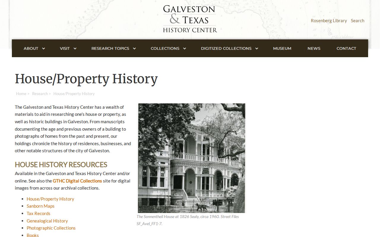
The guide reinforces the needed division of labor: maps locate the physical history, while dated household sources and recorded documents supply the person or transfer evidence.
Check Galveston Previous Residents Endpoints
City Accela and GIS permit layers can date construction, alteration, or site work. Search by street number, street name, unit, city, ZIP, parcel, or owner where the portal allows. Permit results may include owner, applicant, licensed professional, received date, work description, and status. They are useful building-date evidence, but none of those roles establishes that a named party lived at the address. Historical online permit coverage was not published in the research.
Obituaries, recorded deaths, interment records, and probate can mark the endpoint of a past-residents trail. GTHC’s recorded-deaths index has 5,132 names, and it notes that it is not a complete casualty count. An obituary may identify relatives or a former address. Probate can identify an executor or heir. Verify any heir relationship in the probate case and deed before treating it as part of the property chain, and never infer a person’s residence from a notice alone.
Verify Galveston Past Residents Instruments
The Galveston County Fidlar search is the public entry point for recorded-instrument name research before an image or copy is checked.
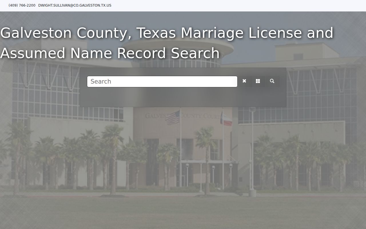
Save the returned party role, document type, date, and legal description with the result. The filed instrument, rather than a name match alone, is the record that can confirm whether a transfer belongs in the property trail.
Protect Galveston Previous Residents Records
The County Clerk provides a free Property Fraud Alert for owners who want notice when a matching recorded document is filed. Several personal or business names can be registered, and the subscriber chooses a notification method. It is a helpful prompt to inspect a new filing in a chain of title.