
Walk a Galveston Street Directory
A street-by-street search begins with the parcel rather than a name. The Galveston Central Appraisal District eSearch connects a street number and street name to a property card. Record the current owner name as an ownership lead, plus the Property ID or Geographic ID, legal description, subdivision, and deed-history details shown. The owner and a correspondence address are not automatically the people living at the situs address. The property card is a cross-reference record, not a certified deed.
- Enter the street number and street name in GCAD, then save the property identifier, Geo ID, situs address, legal description, and any deed-history row.
- Use the county interactive map to find the same address or place, select the parcel, and compare its GEOID, situs, legal, ZIP, land-use, and neighborhood information.
- Search the current owner as a grantee in the County Clerk instrument index, matching the legal description before treating an instrument as part of this parcel’s chain.
- For voter information, use only the statutory format or request route that Texas law permits. Texas Election Code §§13.004, 18.005, 18.066, and 18.067 limit the available and protected data, and the public status tool is not a countywide street roster.
- For an older household question, consult a dated reverse or criss-cross directory and its abbreviation key. The year and address must both match.
That sequence labels the evidence before it is combined: parcel owner, deed party, voter registrant, permit party, or historical occupant. It does not treat one relationship as another. Note: Preserve the exact address spelling and legal description because coastal postal labels and local situs forms can differ.
Search Galveston Street Directory Fields
GCAD supplies the most detailed current address filters found in the research. Its Street Name instruction says to enter the name without a prefix, suffix, or unit number. Street Number narrows a situs address, while Property ID, Owner ID, and Geographic ID serve as steadier links when a common street name or later address formatting gets in the way. Some controls belong to the appraisal protest process, not to a resident search.
| GCAD field | Input or control | Street use |
|---|---|---|
| Owner Name | Text, last name first | Finds parcels linked to an owner name |
| Street Number and Street Name | Text and autocomplete | Locates the situs address |
| Property ID, Geographic ID, Owner ID | Text | Provides a cross-reference to the parcel or owner |
| Subdivision, Condo, Neighborhood | Autocomplete | Narrows a local area |
| Property Type and Tax Year | Select controls | Filters appraisal record context |
| Abstract and MobileHomePark | Autocomplete | Connects legal or appraisal groupings |
GCAD also offers Advanced and ARB-related fields, including protest status and hearing dates. Those entries describe appraisal activity. They should not be read as proof of an occupant. A homestead exemption is an appraisal-context indicator of owner occupancy, but it is not conclusive evidence that someone is currently at the address.
Use Galveston GIS Street Records
The Galveston County interactive map has a “Find address or place” control and a layer panel. After selecting a parcel, use the identifiers as a bridge back to GCAD and the recorded-instrument search. The county describes its boundaries as approximate and informational, not a survey or legal boundary. A parcel shape can help organize a street segment, but it does not establish a shared household, easement, current occupancy, or ownership.
| GIS layer or service | Useful fields |
|---|---|
| County viewer | Find address or place, search, parcel and map layers |
| City parcel service | GEOID, NAME, address variants, city, state, ZIP, situs, legal, acres, land use, neighborhood, and values |
| City permit service | Owner and owner-address fields, situs and legal, permit type, received date, status, status date, and work description |
The City parcel service metadata says its identified parcel data are updated and distributed twice each year. Its service limit is 2,000 records, so a broad query may need to be narrowed or paginated. A GEOID is especially useful when the street address is inconsistent across a tax roll, map, or older deed.
Check Galveston Street Permit Records
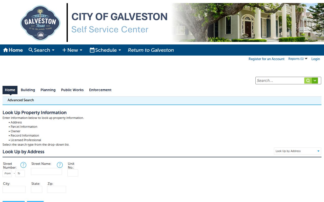
The City’s Accela property lookup offers Address, Parcel Information, Owner, Record Information, and Licensed Professional search types. Address fields include street number from and to, street name, unit number, city, state, and ZIP. That makes it useful for construction and permit history at a particular site. Its dynamic capture did not expose verified required-field markers or every dropdown option, so a search result should be read as a permit record rather than a resident record.
The City Accela lookup shows the address-based search route used for Galveston street-directory research.
Permits can connect a site to work history, an applicant, an owner, a licensed professional, and status dates. Those roles differ. A permit owner, applicant, or professional should never be labeled as a resident without separate occupancy evidence. Public code-case results can likewise be tied to a site or case, but the exact online result fields were not located in the captured official sources.
Compare Galveston Street Directory Records
Address-keyed records answer different questions. Pairing them is more reliable than expecting a single Galveston street directory result to name everyone connected with a house. The table distinguishes records that identify an ownership or document relationship from those that can show a dated historical household or a lawfully released registration record.
| Address record | Keeper | What it can show | Key limit |
|---|---|---|---|
| GCAD parcel card | Galveston Central Appraisal District | Owner, mailing and situs addresses, value, exemptions, legal description, deed-history fields | Owner or mailing recipient is not necessarily the occupant |
| Tax account | Tax Assessor-Collector | Owner, address, account, long account, or fiduciary association | Not the legal title record |
| Recorded instruments | Galveston County Clerk | Grantor, grantee, legal description, instrument and recording details | A deed party need not live at the parcel |
| GIS parcel | County or City GIS | GEOID, situs, legal, ZIP, land-use and parcel geometry | Boundary geometry is informational |
| Accela permit | City of Galveston | Site, work, owner or applicant, and status details | Permit roles are not occupancy evidence |
| Historic directory | Galveston and Texas History Center | Dated address-to-household information where the volume supports it | Read the volume’s year and key |
The Tax Assessor-Collector collects taxes, while GCAD controls ownership, mailing address, value, and exemptions. When the two differ, the appraisal-district card and the recorded instrument are the better places to verify the property relationship. Note: Keep a copy citation or instrument number with every conclusion so a later correction has a clear source.
Review Galveston Street County Permits
Some addresses outside city workflows have a second permit path through Galveston County Engineering. The county moved its permitting to OpenGov, where an account is required for online applications. Its documented categories include floodplain development, new subdivisions or replats, county right-of-way matters, and related county permissions. A floodplain application can carry property and owner information, owner acknowledgment, flood-zone and unincorporated-status review, and supporting attachments.
Those records can date site work and identify the role stated in the application. They do not create an address-to-resident list. For a coastal parcel, the county workflow can also distinguish incorporated from unincorporated context and flag flood-zone or mean-high-tide issues that help explain why a county record exists beside a City Accela record. Preserve the jurisdiction and record type before joining either to a deed or parcel card.
Trace Galveston Street Directory Deeds
For a transfer sequence, use the County Clerk Fidlar index or the linked AVA real-property viewer. The County Clerk’s captured pages did not publish a complete official online historical cutoff, and their dynamic controls did not provide verified detailed field requirements. A hit should be checked against the instrument image or a certified copy when title, identity, or a historical claim matters.
- Parcel
- A defined piece of land tracked in the appraisal and mapping systems.
- Situs address
- The physical location assigned to a parcel, which can differ from the mailing address used for tax correspondence.
- Plat
- A recorded plan that can identify lots, blocks, subdivisions, easements, and street layout.
- Criss-cross directory
- A historical directory arranged from address to occupant or household, when the particular volume includes that format.
Match the legal description, not merely a familiar street string. Lot, block, subdivision, or metes-and-bounds language can bridge an older document to a current address. Recording date and deed date are separate facts. Fidlar and AVA are useful index access points, but neither verified a full coverage boundary in the captured research.
Read Galveston Street Directory History
For a historical name at an address, the Galveston and Texas History Center holds city directories spanning 1856 through 2024, with digitized, bound, microfilm, and database routes split by era. A reverse or criss-cross volume can turn a street number into a dated household lead. The exact Galveston reverse-directory years and publishers were not separately listed, so request the specific year and ask for its key before treating an abbreviation as a fact. The broader holdings are described in the Galveston city directories collection.
Street research needs special care around the 1900 Storm. Damage, rebuilding, grade raising, and later changes in shoreline or address context can make similar address lines refer to different structures or families. Compare legal description, lot and block, and a Sanborn sheet where available rather than assuming a modern street number solves the match.
City of Galveston Maps and GIS provides the city’s map and GIS access point for checking a parcel’s current geographic context.
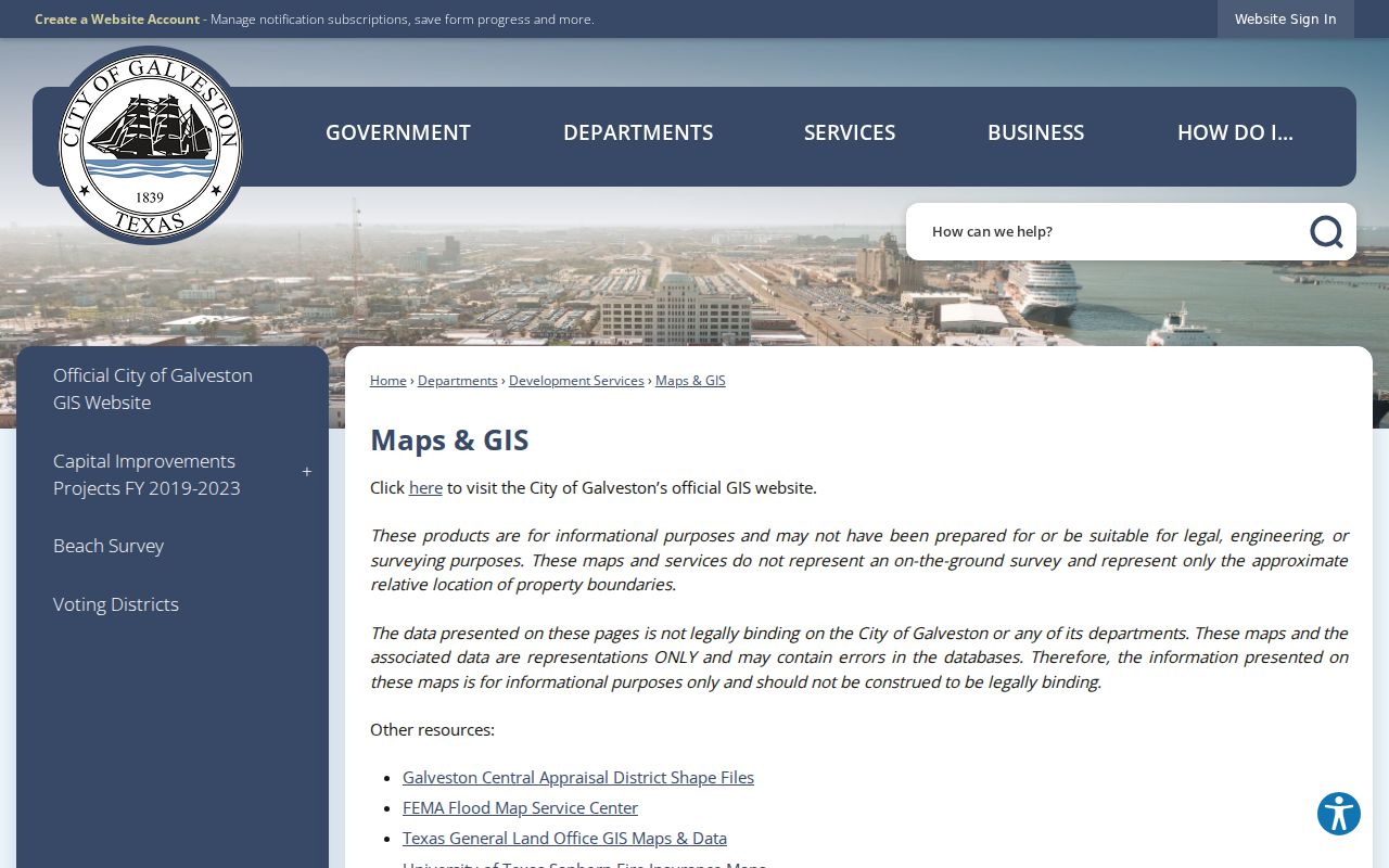
Use the current map as a locator, then keep the historic source’s own date, address form, and legal description beside it. A map helps reconcile places, but it cannot identify a past household on its own.
Separate Galveston Street Directory Roles
Galveston records often place different people beside the same address: an owner, mailing recipient, deed party, permit applicant, voter registrant, or historical occupant. The words on the record matter. A tax mailing address can be far from the physical parcel. A homestead notation is not a live presence check. A deed from a trust, estate, corporation, or attorney-in-fact may document a transfer without naming an everyday household member.
A street search cannot reveal every occupant, a non-owner household member, utility customer, delivery record, or closed DMV address. Postal geography adds another limit. A USPS city label may not match the municipality or parcel jurisdiction, and a PO Box or unique ZIP is a mailing route, not a physical residence. Preserve the address exactly as printed, then compare situs, legal description, and county or city jurisdiction through the appropriate property source.
Protect a Galveston Street Record
The County Clerk offers a free Property Fraud Alert. An owner can register several personal or business names and choose a notification method for a matching recorded document. It is useful as a prompt to inspect a newly filed record, especially when a parcel’s deed chain matters.
The alert is not a title determination and does not replace checking the underlying instrument. For a disputed document or a chain that requires formal proof, compare the recorded image, legal description, and Clerk-certified materials instead of relying on a name-match alert.